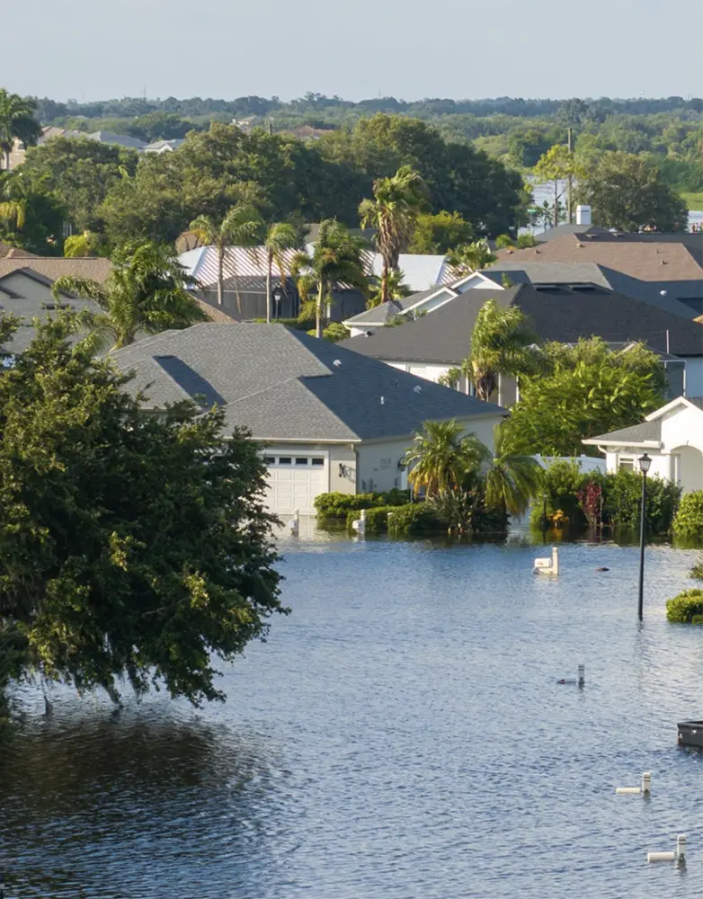
Coastal property in New South Wales has plenty of pull, but water isn’t just a view—it’s a factor that can shape the life and value of a home. Some streets stay dry no matter the storm, while others see water rise fast with little warning. Flood and coastal risk maps exist for a reason, and knowing how to read them can make the difference between a smooth purchase and years of expensive surprises.
Why These Maps Should Be on Your Radar
Risk maps aren’t something to skim over. They carry years of recorded weather events, projections from coastal engineers, and details that can affect building approvals. A street flagged for high flood exposure could face extra rules for renovations or even future resale hurdles.
Buyers who treat these maps as part of the early search—not as fine print—can spot red flags before getting attached to a property. In some cases, it’s the one step that stops a purchase from turning into a headache.
Making Sense of What You See
Each council presents its mapping differently. Colours, lines, and codes aren’t always consistent. Some highlight floodplains, while coastal overlays show erosion buffers and storm surge zones.
A buyers agent in South Coast would go beyond the colour codes. They’d compare the map with the actual slope of the land, nearby drainage points, and past weather patterns. This double layer of checking helps reveal whether a neat-looking block is sitting in a natural runoff path.
On-the-Ground Details That Matter
Maps are a starting point, but there’s more to the story. Properties can carry hidden risks you only catch when you know where to look.
Land elevation – Lower spots can collect water fast during a downpour.
Creek or gully proximity – Small waterways can rise quickly than rivers.
Coastal setback lines – Show how far from the water you can legally build.
Storm tide exposure – Indicates areas open to saltwater surges.
Historic flood data – Past patterns often repeat, regardless of upgrades.
When Risk Doesn’t Mean Walking Away
A flagged property isn’t always a no-go. Some homes have been built with raised foundations or drainage systems designed to handle overflow. In those cases, the cost of higher insurance might still balance out with location benefits.
It’s about weighing the risk against your purpose for the property. An owner-occupied beach house might be worth the trade-off, but a rental in the same zone could lose income if tenants are forced out for repairs.
Using Local and State Tools
NSW councils keep online mapping portals with hazard overlays, zoning info, and development guidelines. The NSW Flood Data Portal and Coastal Management Programs go even deeper, showing regional projections that can influence long-term planning.
Don’t just zoom in on the property line. Look at how neighbouring streets sit in relation to water flow. Sometimes the safest block is just one street over from a flood-prone zone. Checking different years of data can also reveal if hazard areas are expanding.
Finding the Value in Safer Ground
Waterfront or water-view homes will always attract interest, but the market is changing. Buyers are more aware of climate impacts, and insurers are adjusting premiums to reflect that. This creates a price gap between similar homes with different risk levels.
That gap can work in your favour if you’re willing to look slightly inland. Sellers in low-risk zones may have a stronger case for stable pricing, and those properties could hold their value longer.
Planning Ahead for Policy Changes
What’s acceptable to lenders and insurers today might shift in a decade. Properties that already sit in high-risk zones could face tougher borrowing or cover conditions. Buying with future rules in mind avoids the risk of owning a home that’s harder to finance or protect.
Keeping risk checks at the front of the search process saves time. You’ll spend more effort on properties that meet both your needs and safety standards instead of chasing listings that won’t work in the long run.
Seeing It in Real Life
Even the best map can’t match a site visit. A property might look fine on paper, but show clear signs of past water damage up close. Visit after heavy rain if possible, or speak with neighbours who’ve seen the area through different seasons.
Matching the technical side with real-world checks makes for a safer buy. In a state where the weather can turn fast, that extra step can mean owning a home that’s as secure as it is appealing.